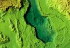
Google recently demonstrated a robotic, LiDAR-equipped car to a New York Times reporter. They are making a significant investment in autonomous vehicle navigation. I would assume this is has to do with the use of their Street View database.
One main technique used by the Google team is known as SLAM, or simultaneous localization and mapping, which builds and updates a map of a vehicle’s surroundings while keeping the vehicle located within the map. This is where the Google map database comes into use.
It looks like Google wants to be sure there will be a use for their 3D data.


